Log in
All resources
Create a design
40,080 Free Images of 1890 Maps
maps in the library of congress
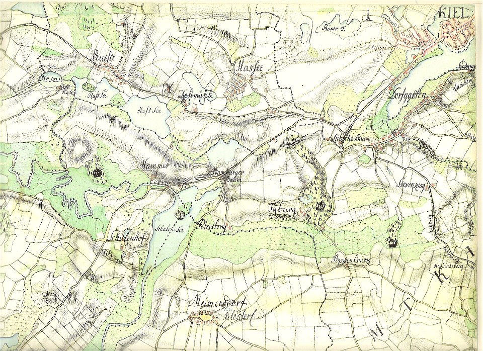
18th-century maps of schleswig-holstein
maps by gustav adolf von varendorf
old maps of kiel
albert ruger
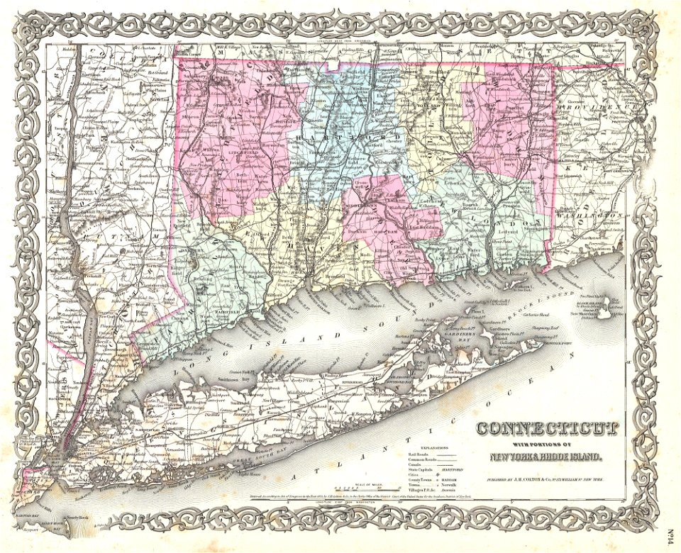
maps by joseph hutchins colton
daniel de la feuille
o. h. bailey
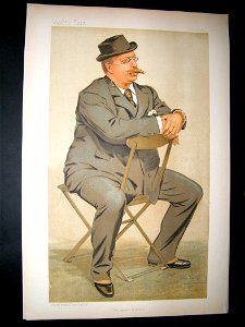
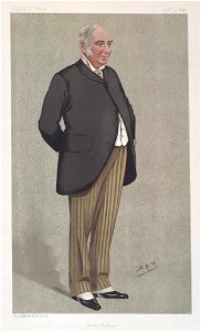
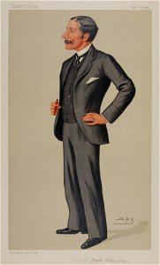
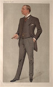
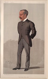
caricatures by leslie ward in vanity fair
list of vanity fair (british magazine) caricatures (1890–1894)
girls looking at viewer in art
portraits holding carnation
1929 deaths
1847 births
1890s paintings in private collections
oil paintings of hunters
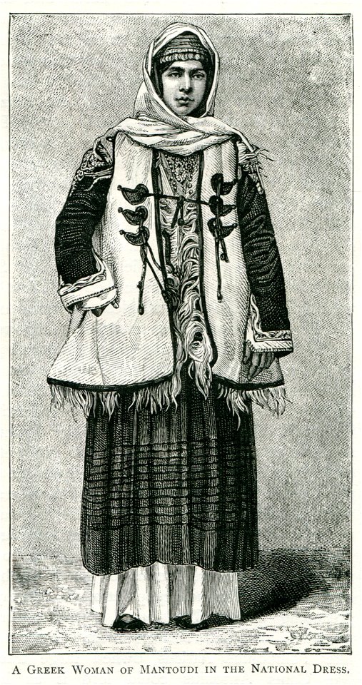
fur clothing of native people of greece
fur fashion in 1890
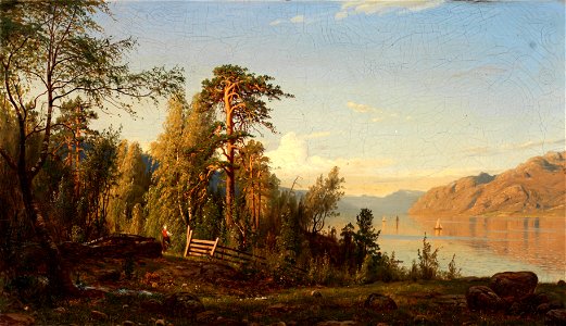
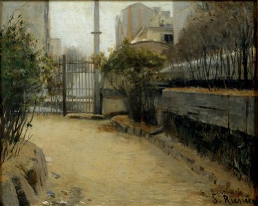
19th-century oil on canvas paintings of landscapes in norway
19th-century landscape paintings from norway
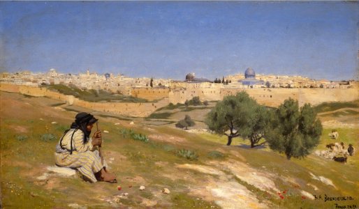
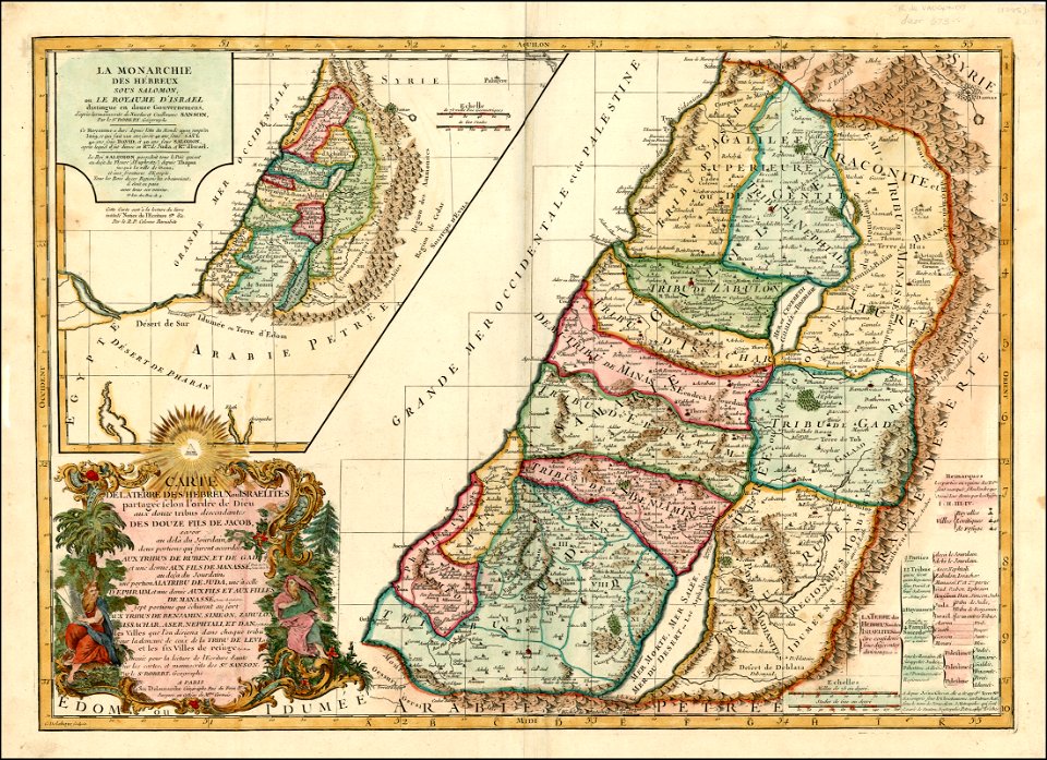
jerusalem in 19th-century art
pastoral landscape paintings
card magic
1890
card magic
1890
european paintings in the indianapolis museum of art
1890 paintings
19th-century oil on panel paintings
1890 landscape paintings
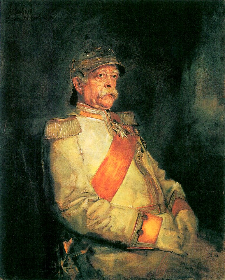
otto von bismarck in 1890
19th-century cuirassiers
otto von bismarck in 1890
19th-century cuirassiers
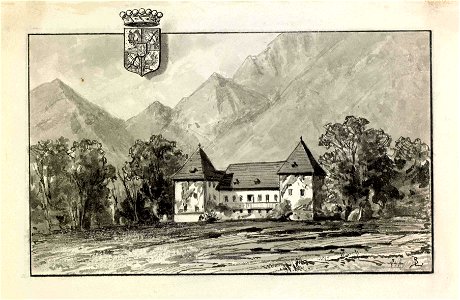
drawings in the national museum of slovenia
drawings of castles in slovenia
19th-century portrait photographs of men at half length
1890 portrait photographs of men
list of vanity fair (british magazine) caricatures (1890–1894)
caricatures by leslie ward in vanity fair
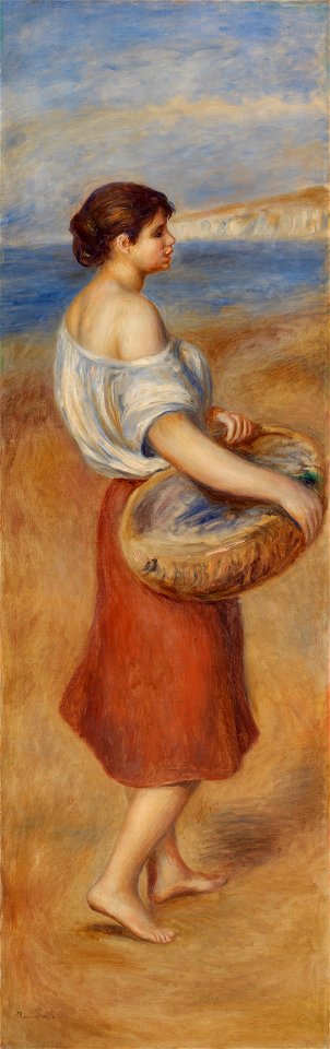
paintings of women by pierre-auguste renoir
fish in art
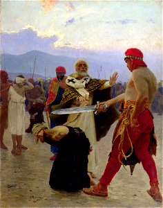
decapitation in paintings
kharkiv,
1890s paintings of people
portrait paintings of men
modern art paintings in the mnac
1891 in paris
list of vanity fair (british magazine) caricatures (1890–1894)
caricatures by leslie ward in vanity fair
caricatures by leslie ward in vanity fair
william hunter kendal
caricatures by leslie ward in vanity fair
vanity fair caricatures (politicians)
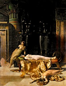
19th-century paintings of the death of cleopatra
mythological paintings by john collier
maps showing 19th-century history
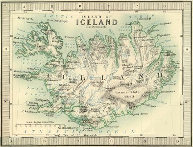
old maps of iceland
maps in the library of congress
1639 maps
arizona
phoenix
maps in the library of congress
iowa
maps by jacques-nicolas bellin
19th-century maps of africa
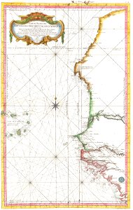
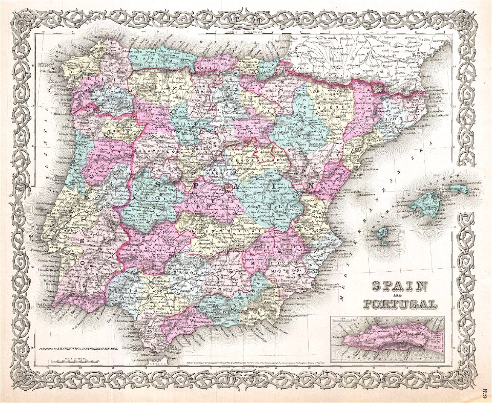
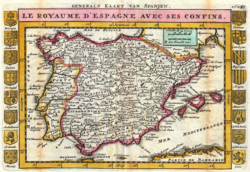
old maps of the iberian peninsula
1850s maps of portugal
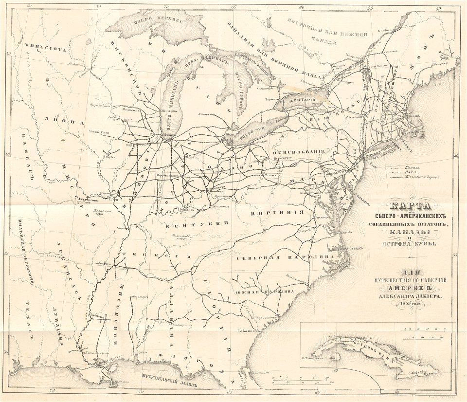
old maps of the united states
1859 maps
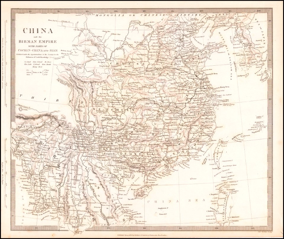
old maps of thailand
old maps of myanmar
maps in the library of congress
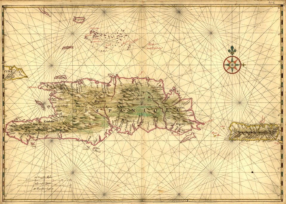
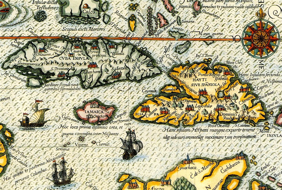
17th-century maps of hispaniola
old maps of the iberian peninsula
johannes ratelband
old maps of switzerland
johannes ratelband
french-language maps
johannes ratelband
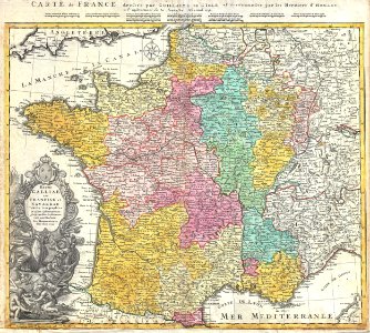
administrative history of france
johann baptist homann
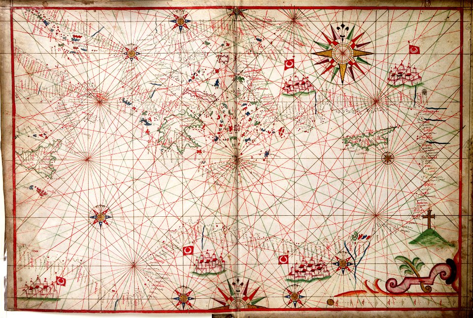
16th-century maps of the black sea
coats of arms on maps
charts and maps of the royal museums greenwich
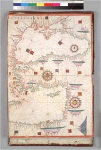
17th-century maps of the mediterranean sea
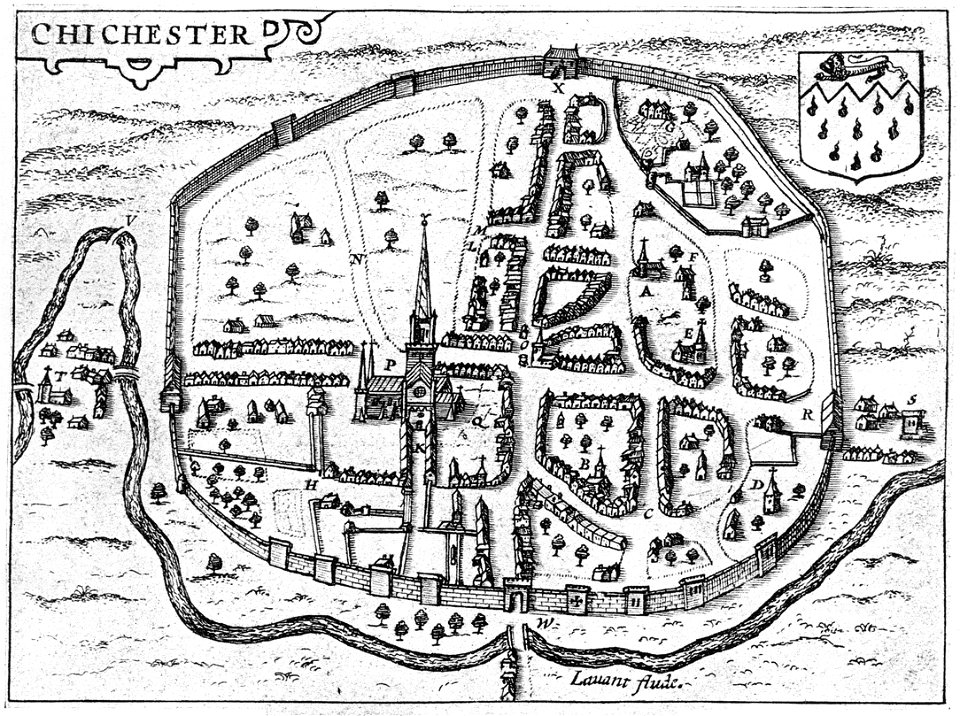
west sussex
chichester
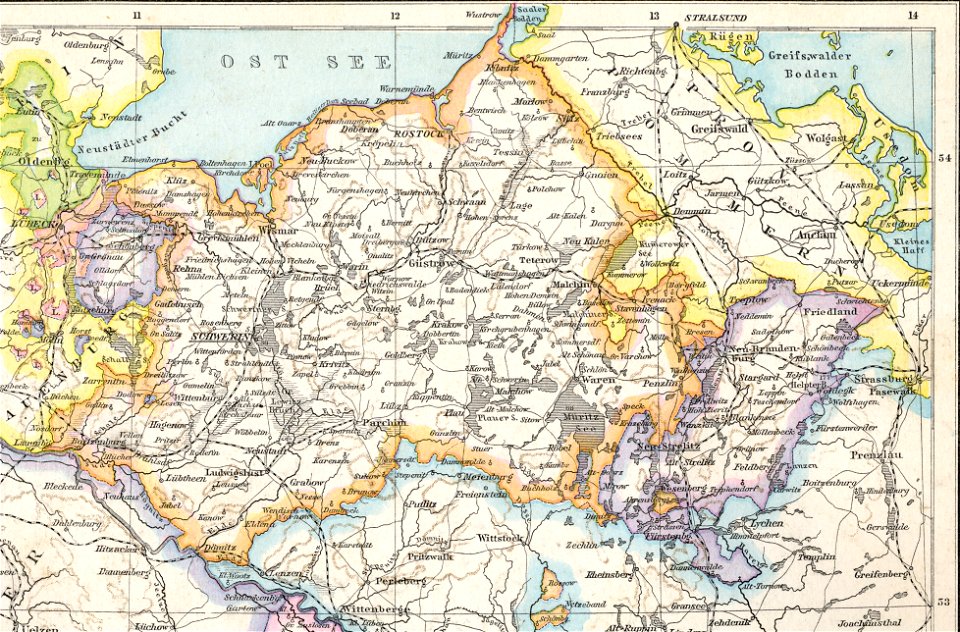
old maps of mecklenburg
1880 maps
charles françois delamarche
old maps of the holy land
johann baptist homann
ships on maps
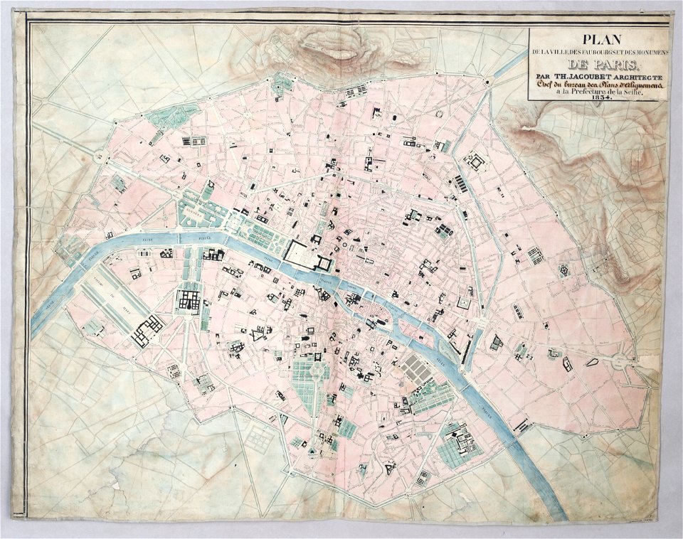
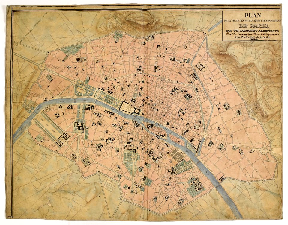
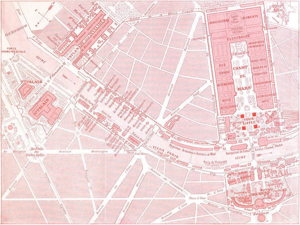
maps of paris from paris musées
1830s maps of paris
maps of paris from paris musées
1830s maps of paris
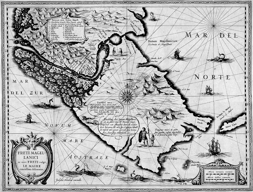
maps by jodocus hondius
1628 maps
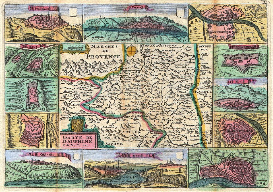
volume 6 of le tour du monde
1860s maps of eritrea
christian gottfried heinrich geißler
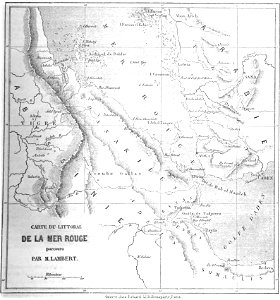
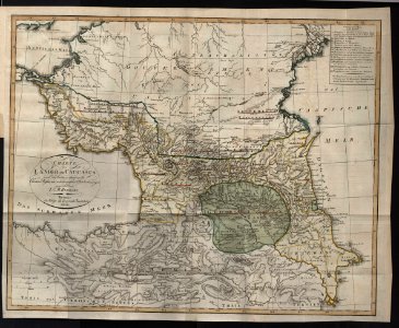
19th-century maps of the caucasus
long island sound
block island
old maps of colombia
theodor de bry
rohatyn
halych
1900s maps of paris
engravings of paris
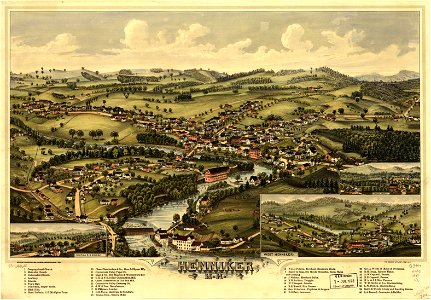
new hampshire
henniker
new hampshire
henniker
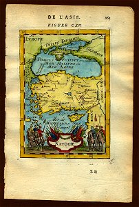
17th-century maps of the black sea
old maps of turkey
maps by frederick de wit
vollenhove
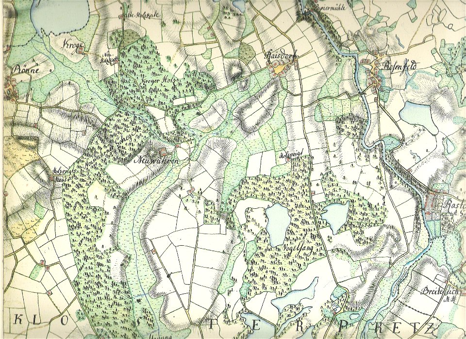
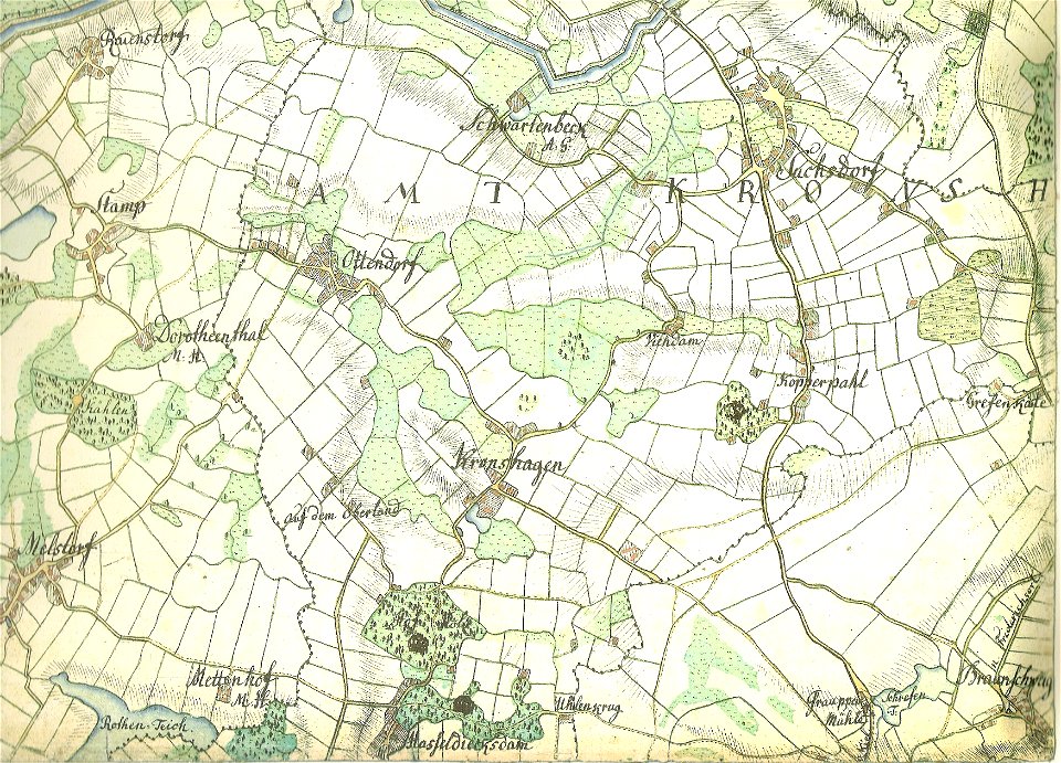
18th-century maps of schleswig-holstein
maps by gustav adolf von varendorf
maps by benedetto bordon
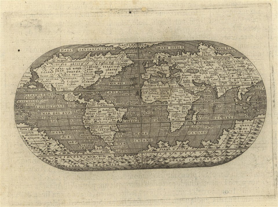
1540s maps of the world
maps in the library of congress
old maps of pennsylvania
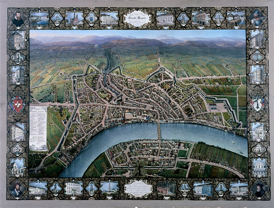
historisches museum basel
maps of basel
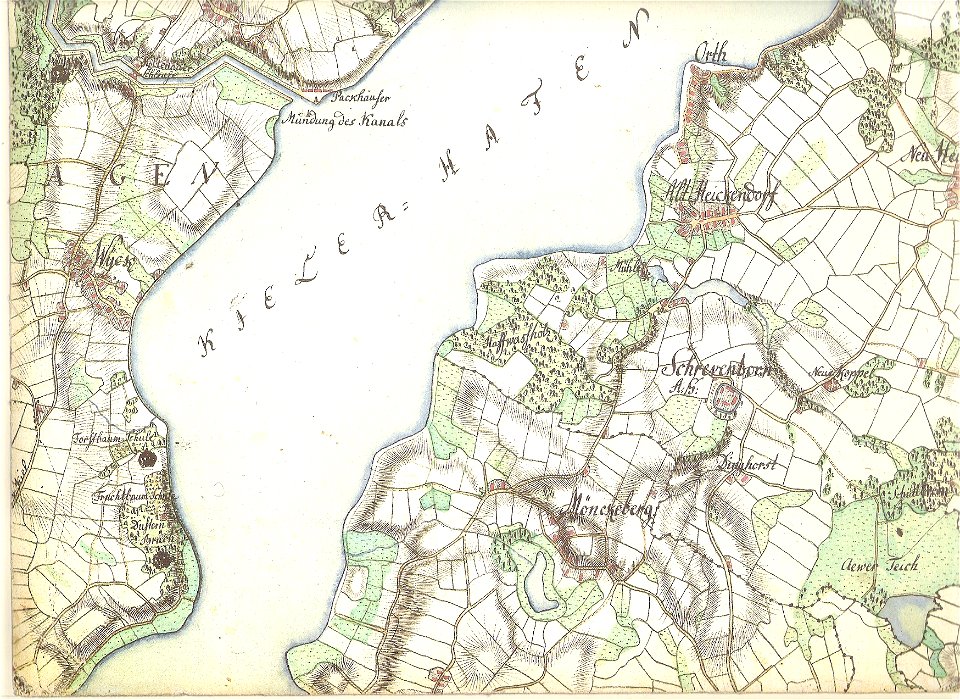
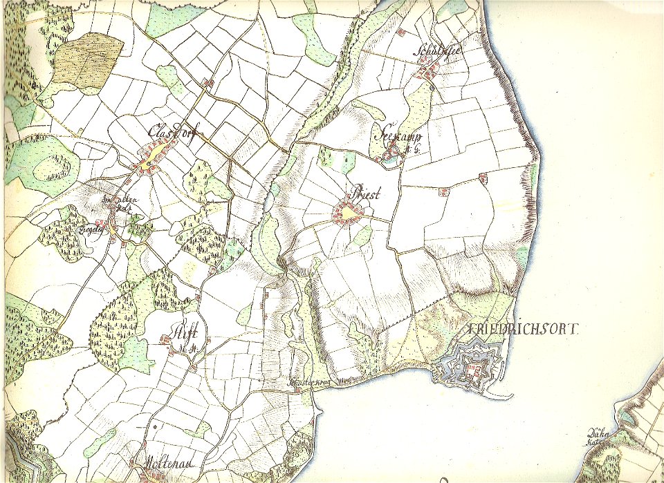
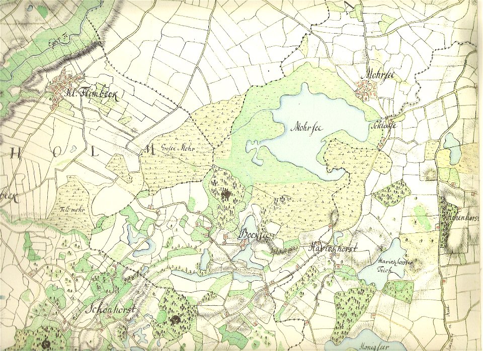
18th-century maps of schleswig-holstein
maps by gustav adolf von varendorf
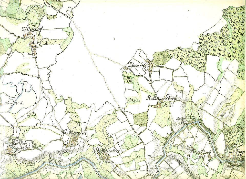
18th-century maps of schleswig-holstein
maps by gustav adolf von varendorf
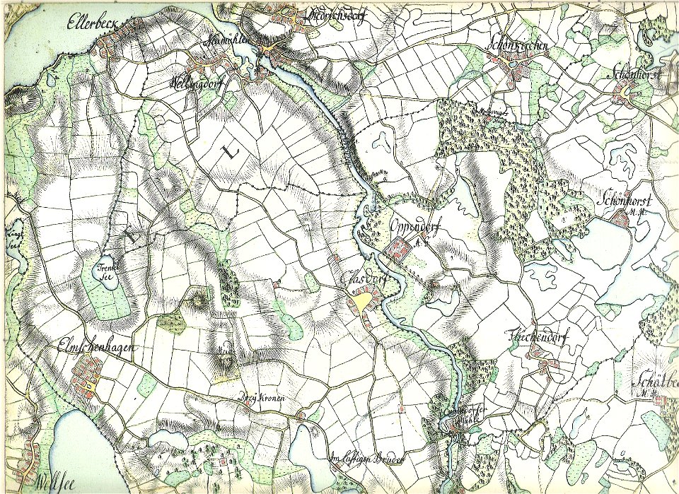
18th-century maps of schleswig-holstein
maps by gustav adolf von varendorf
18th-century maps of schleswig-holstein
maps by gustav adolf von varendorf
18th-century maps of schleswig-holstein
maps by gustav adolf von varendorf
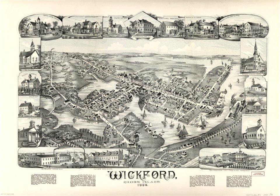
maps in the library of congress
o. h. bailey
maps in the library of congress
o. h. bailey
18th-century maps of schleswig-holstein
maps by gustav adolf von varendorf
18th-century maps of schleswig-holstein
maps by gustav adolf von varendorf
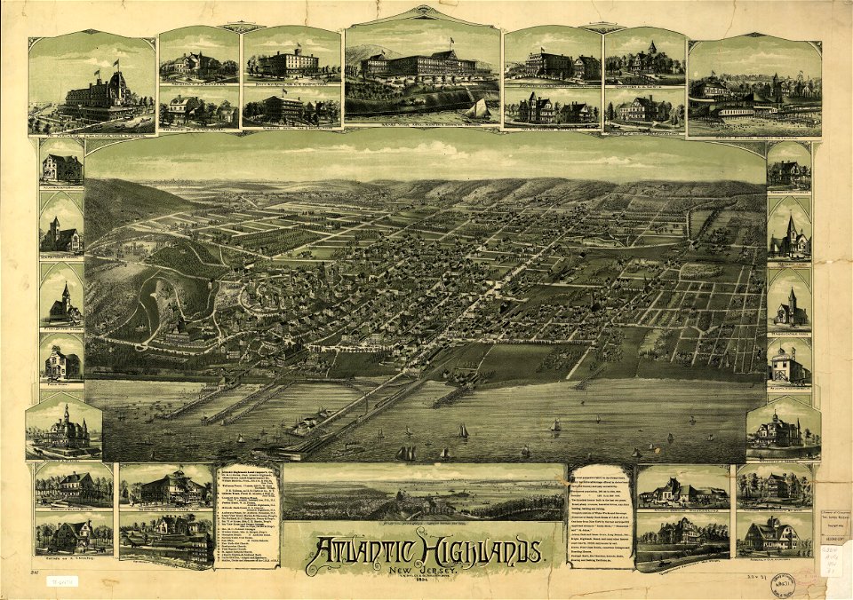
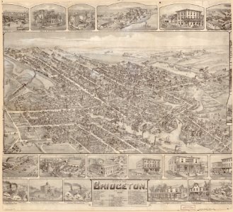
o. h. bailey
1894 maps
o. h. bailey
1894 maps
maps in the library of congress
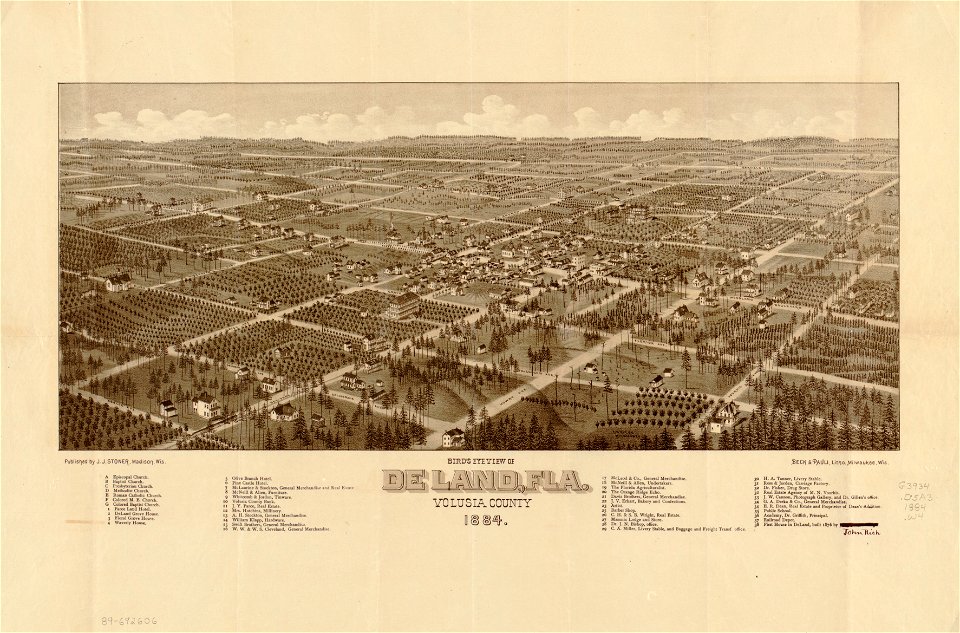
florida
maps in the library of congress
florida
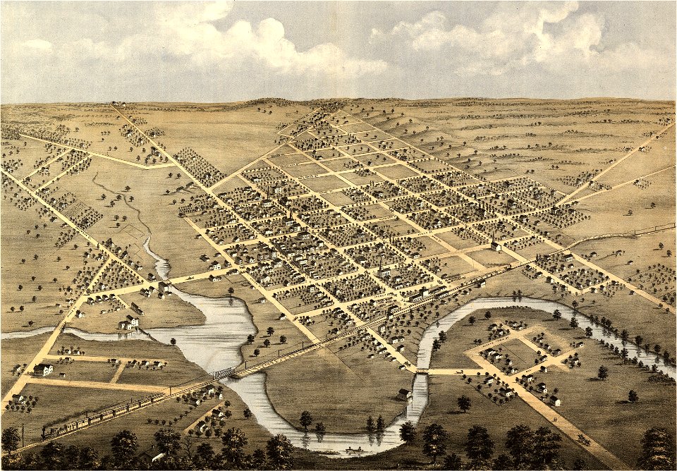
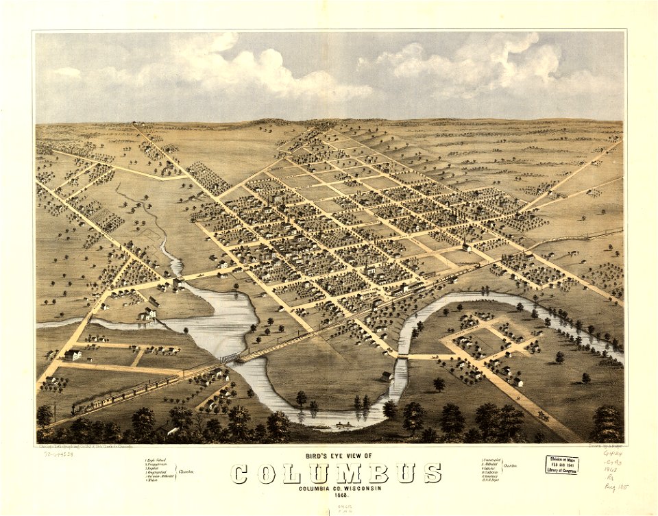
wisconsin
columbus
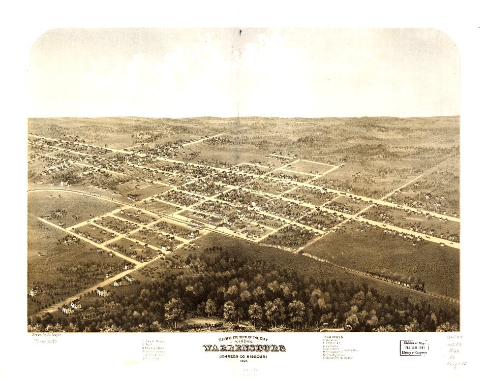
missouri
mexico
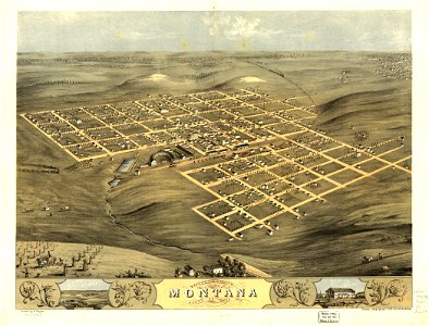
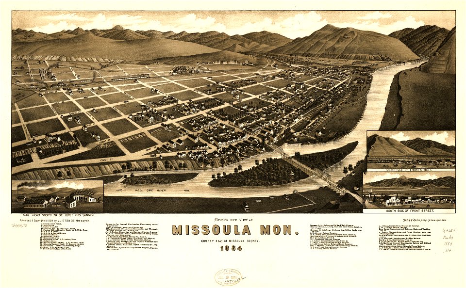
missoula
montana
wisconsin
columbus
maps in the library of congress
1867 maps
maps in the library of congress
missouri
missoula
montana
maps in the library of congress
missouri
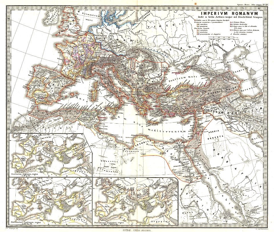
karl spruner von merz
1865 maps of europe
karl spruner von merz
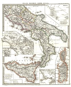
old maps of sardinia
old maps of the roman empire
1865 maps
old maps of the roman empire
1865 maps
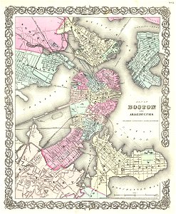
maps by joseph hutchins colton
1855 maps
maps by joseph hutchins colton
1855 in boston
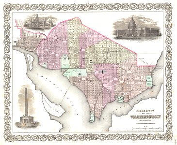
19th-century maps of washington
d.c.,
maps by joseph hutchins colton
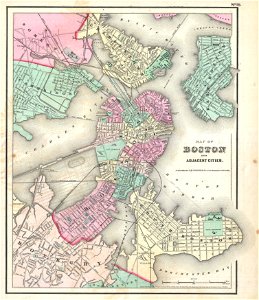
1857 in boston
maps by joseph hutchins colton
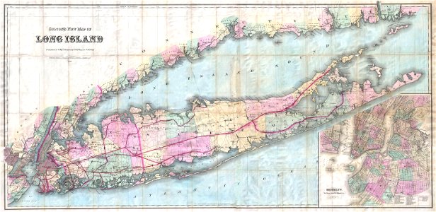
1880 maps of new york (state)
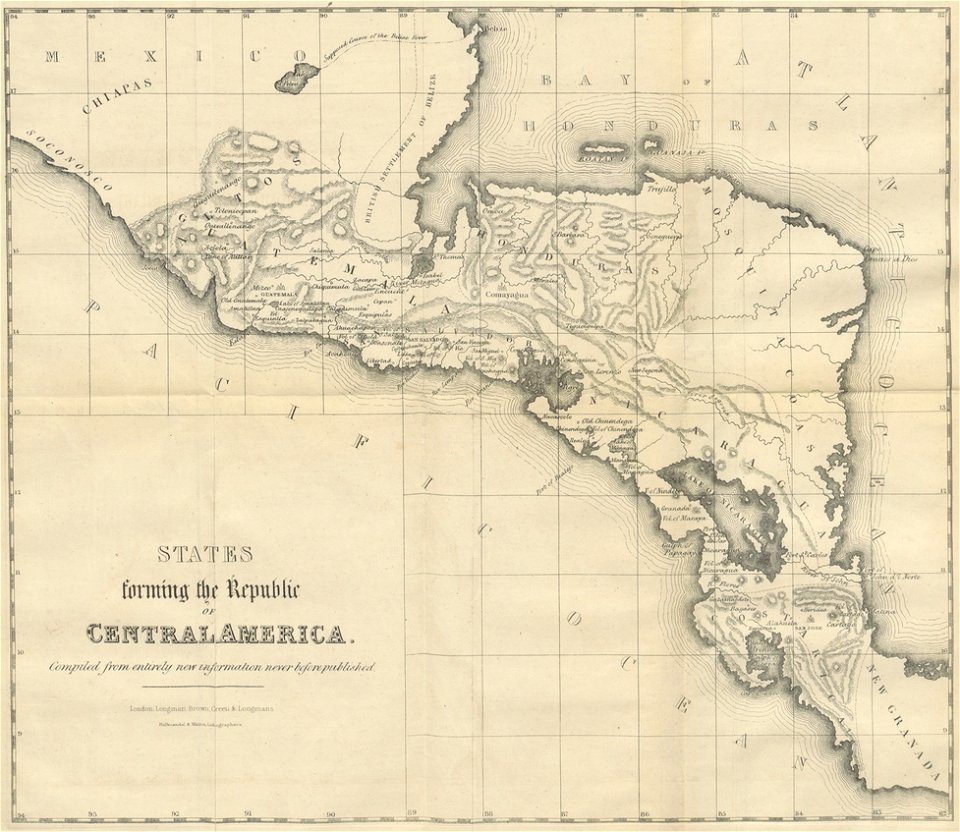
maps from the mechanical curator collection
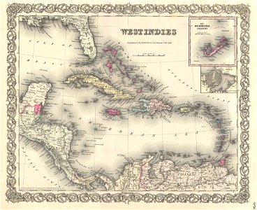
19th-century maps of central america
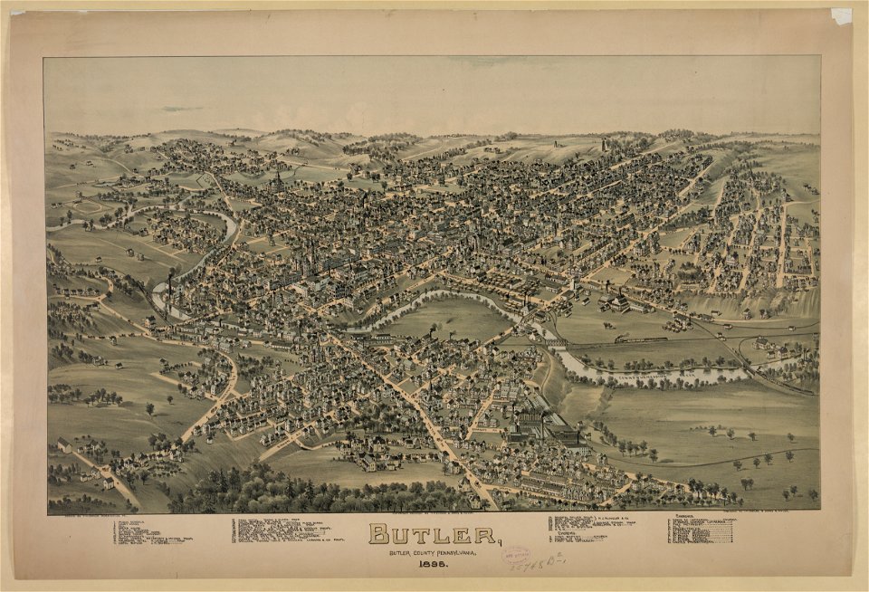
pennsylvania
butler
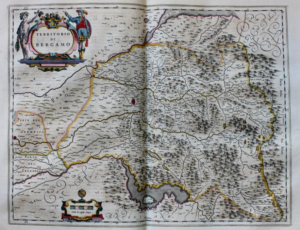
geographia blaviana
1659 maps
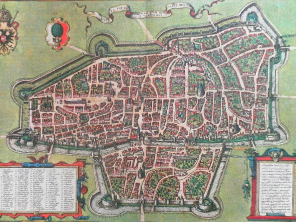
maps with cartouches
braun & hogenberg
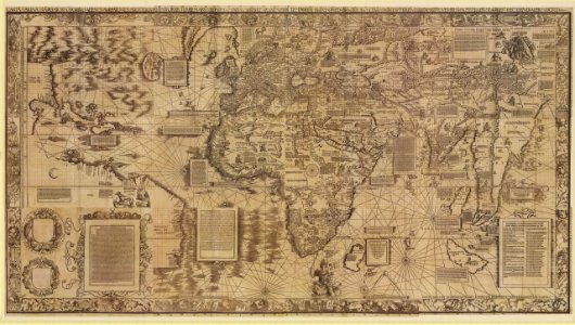
maps by martin waldseemüller
1510s maps of the world
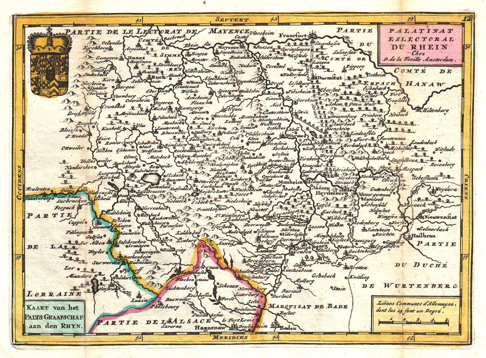
johannes ratelband
1747 maps
old maps of rhineland-palatinate
johannes ratelband
maps in the library of congress
o. h. bailey
maps in the library of congress
o. h. bailey
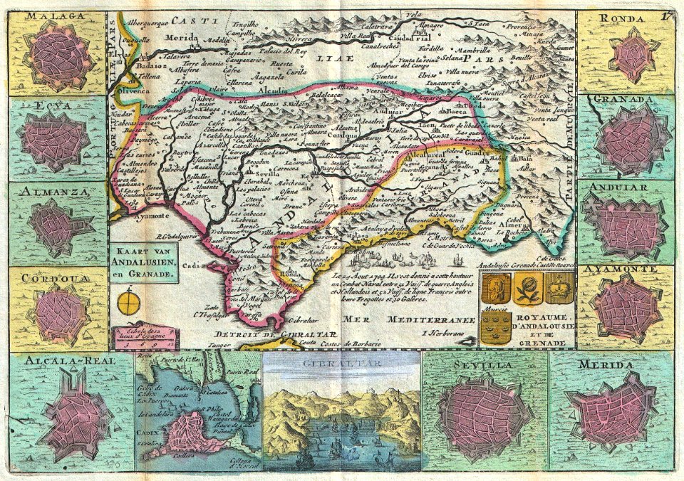
old maps of gibraltar
covens en mortier
maps in the national library of australia
1572 maps
4201 - 4300 of 40,080
Next page
/ 401